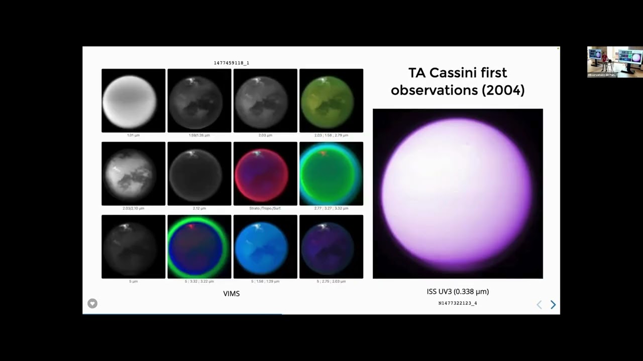
Seeing through the haze the CassiniHuygens challenge of mapping Titan's surface
Keywords
Summary
176 words
Critical Evaluation
Value of the Information & Strength of the Argument
The talk provides valuable insights into the process of planetary mapping, emphasizing the technical challenges and the collaborative effort required. The argumentation is solid, based on direct experience and references to published research. The speaker clearly explains the limitations of each instrument and the rationale behind combining datasets, which strengthens the credibility of the information.
Scientific Rigor, Source Quality, Title Accuracy
The speaker references specific papers and datasets, such as the 1991 paper by Caitlin Griffith and the global maps by Christophe Sotin and Eric Karkoschka. The title accurately reflects the content, focusing on the challenge of seeing through Titan’s haze. The talk is scientifically rigorous, with no apparent inaccuracies, and the speaker acknowledges uncertainties and limitations in the data.
129 words
Title / Content Match
The title accurately reflects the content, which focuses on the challenges and methods of mapping Titan's surface through its hazy atmosphere using Cassini-Huygens data.
Quality & Reliability
8/10
The talk is given by a researcher directly involved in the Cassini mission, providing first-hand knowledge and referencing peer-reviewed publications and mission data. The content is consistent with established scientific knowledge about Titan's surface mapping.
Key Moments
Markers derived by PSI from the transcript: the creator did not define chapters.
- Introduction to the challenge of seeing Titan's surface through its haze.
- Discussion of early Voyager images and the misconception about Titan's color.
- Explanation of the first hints of surface visibility in infrared wavelengths.
- Hubble observations and the first surface features detected.
- Ground-based observations with adaptive optics and the first resolved surface images.
- Cassini's arrival and the first clear views of the surface with VIMS and ISS.
- Building global maps from VIMS data, including the work of Christophe Sotin.
- ISS global mapping and the work of Eric Karkoschka.
- RADAR mapping and its limitations in global coverage.
- Combining VIMS and ISS data to create a consistent global map.
Cited Sources
- Griffith et al. 1991 (paper on Titan's surface visibility) — Referenced as the first hint that Titan's surface could be seen in infrared windows.
- Sotin et al. (global VIMS map) — Mentioned as the source of the global VIMS map assembled from 19,000 cubes.
- Karkoschka et al. (global ISS map) — Referenced as the source of the global ISS map published in 2018.
Concurring Sources
- NASA Photojournal — Mentioned as a repository for the global maps.
- USGS Astrogeology — Mentioned as the location for the updated geodetic map.
Contribution & Novelties
This talk provides a comprehensive historical perspective on Titan surface mapping, synthesizing decades of efforts from multiple missions and instruments. It highlights the technical challenges and the collaborative nature of planetary science. The speaker also shares recent updates, such as the new ISS map published two weeks prior, and discusses the upcoming Dragonfly mission.
Pour aller plus loin :
- Titan (moon) - Wikipedia — Provides general information about Titan, its atmosphere, and surface features.
- Cassini-Huygens - NASA Science — Official mission page with details on the spacecraft and its discoveries.
- Dragonfly (spacecraft) - Wikipedia — Information about the upcoming Dragonfly mission to Titan.
103 words
Radar Profile
The radar profile shows high scores across all dimensions, indicating a well-balanced and reliable presentation. The talk is rich in information, technically sound, and based on credible sources, with a strong overall reliability.
💬 No comments were provided for analysis.