Synergie sol-espace pour un meilleur échantillonnage spatio-temporel
Keywords
Summary
167 words
Critical Evaluation
Value of the Information & Strength of the Argument
The talk provides valuable insights into the complementary roles of ground-based and space-based observations in atmospheric monitoring. The argumentation is solid, grounded in decades of experience and specific examples from ozone and temperature measurements. Keckhut effectively illustrates how combining different techniques can overcome individual limitations, such as the poor vertical resolution of many satellites or the sparse spatial coverage of ground stations. He also highlights the importance of long-term, well-calibrated datasets for detecting climate trends, and the need for careful intercalibration to avoid spurious signals. The presentation is persuasive in advocating for a multi-platform approach, and it offers a clear rationale for continued investment in both ground networks and satellite missions.
Scientific Rigor, Source Quality, Title Accuracy
The scientific rigor is high, with references to established networks (GRUAN, NDACC), satellite missions (UARS, Envisat, OMPS), and specific datasets. The speaker is a recognized expert, and the content aligns with current scientific understanding. The title accurately reflects the content, focusing on the synergy between ground and space observations. The presentation does not include formal citations, but the described networks and missions are well-known in the field. The talk is a conference presentation, so it is not peer-reviewed, but the information is consistent with published literature. The adequacy between title and content is excellent, as the talk directly addresses the theme of spatio-temporal sampling.
230 words
Title / Content Match
The title accurately reflects the content, which focuses on combining ground-based and space-based observations to improve spatio-temporal sampling of the atmosphere.
Quality & Reliability
8/10
The speaker is a recognized expert in atmospheric remote sensing, and the presentation draws on established measurement networks and satellite missions. However, the talk is a conference presentation without formal peer review, and some specific data trends are presented without detailed uncertainty quantification.
Key Moments
Markers derived by PSI from the transcript: the creator did not define chapters.
- Introduction: speaker introduces himself and the topic of solar-space synergy.
- Comparison of geostationary and low-Earth orbit satellites for atmospheric observation.
- History of balloon-borne measurements and the discovery of the stratosphere.
- Discussion of instrumental discontinuities and the GRUAN network for reference measurements.
- Use of GPS radio occultation for vertical profiling and comparison with radiosondes.
- Observations of stratospheric cooling and the role of ozone depletion.
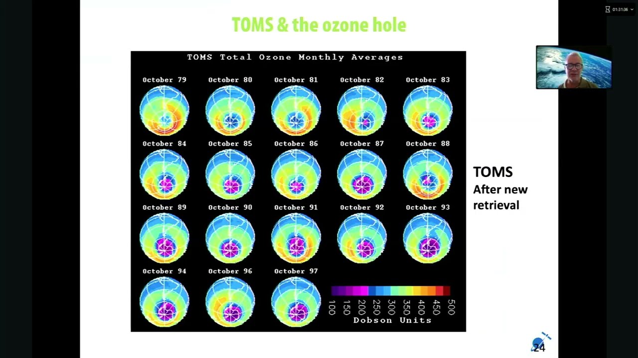
- Discovery of the ozone hole and the importance of ground-based networks for validation.
- Development of new ground-based techniques for measuring temperature and wind.
- Use of stellar occultation (GOMOS) and OMPS for atmospheric profiling.
- Conclusion: emphasis on the need for continued synergy between ground and space observations.
Cited Sources
- GRUAN (GCOS Reference Upper-Air Network) — Mentioned as a network for reference-quality upper-air measurements.
- NDACC (Network for the Detection of Atmospheric Composition Change) — Referenced as a network of ground-based instruments for atmospheric composition monitoring.
- UARS (Upper Atmosphere Research Satellite) — Mentioned as the first major NASA satellite for atmospheric research.
- Envisat — Mentioned as a satellite carrying the GOMOS instrument.
- OMPS (Ozone Mapping and Profiler Suite) — Mentioned as a newer satellite instrument for ozone and temperature profiling.
Concurring Sources
- GRUAN (GCOS Reference Upper-Air Network) — Supports the need for reference-quality ground-based measurements to validate satellite data.
- NDACC (Network for the Detection of Atmospheric Composition Change) — Provides long-term ground-based observations that are used to validate satellite measurements.
Contribution & Novelties
The talk provides a comprehensive overview of the complementary roles of ground-based and space-based observations in atmospheric monitoring, emphasizing the importance of synergy for improved spatio-temporal sampling. It highlights specific challenges such as instrumental discontinuities and the need for careful intercalibration, and showcases examples from ozone and temperature measurements. The presentation also discusses the development of new ground-based techniques and the use of innovative satellite methods like stellar occultation.
Pour aller plus loin :
- Radio occultation — A technique used for atmospheric profiling, relevant to the GPS occultation discussed.
- Ozone depletion — Background on the ozone hole and its recovery, central to the talk.
- Lidar — Ground-based remote sensing technique used for atmospheric profiling, mentioned in the talk.
118 words
Radar Profile
The radar profile shows high scores in information quantity, quality, and reliability, with a slightly lower score in technical level, indicating that the talk is accessible to a general scientific audience while still providing substantial expert content.
💬 No comments were provided for analysis.